Uba
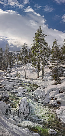
Location: North Yuba River, California State Route 49, east of Big Bend, CA
Created: 02/26/2017 9:40:22 am
Camera: EOS Canon 5D iii
Lens: EF 70-200mm 2.8L IS ii USM @ 70 mm
Aperture: f/18; 1/640 sec ; 3 shot vertical pano
This is the Yuba River near Cisco Grove; the headwaters drain the melting snow from Yuba Pass and its surrounding peaks. This wild river here is usually tame. However, after the second wettest year ever on record, in February 2017 (2023 gets #1), the water raged at over 23,000 cubic feet per second. Downstream, running free from New Bullards Bar Reservoir, the river doubles in volume at the confluence of Downie River. The Yuba then becomes a significant tributary to the Feather River, which eventually joins the Sacramento River and provides abundant year-round agricultural irrigation water to a hefty portion of our Central California Valley's rich farmlands. Legend has it that the Yuba River got its name in the early 1800s from the wild grapes Spanish explorers found growing densely along the riverbank. 'Uva,' the Spanish word for grape, was transformed into its current designated name, 'Yuba.' What I find fascinating about this region is the profound transformation that occurs each season. The once-frothing waterfall becomes a peaceful tumble in the Fall months, and the surrounding exposed rocks become covered in dazzling green moss. The river's chameleon-like personality is as different as wild grapes in the spring versus fine wine in the fall.